|
North Walsham
& Dilham Canal River Ant |
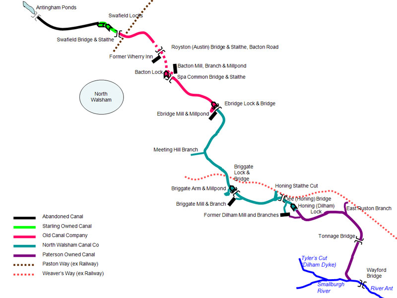
The North Walsham & Dilham Canal was built in 15 months after an Act of Parliament in 1812. Prior to building the canal the River Ant was navigable as far as Dilham_mill, which used Dilham Lake for its supply of water. When built, the canal was 8¾ miles long and had 6 locks. It ran from Wayford Bridge to Antingham Lower Bone Mill |
|
The act for forming the canal; was obtained in 1812, under the title of An Act for making a navigable Canal from the Rivers Ant and Bure, at or near Wayford Bridge, near Dilham, to the towns of North Walsham and Antingham, in the county of Norfolk. The proprietors were incorporated as The Company of Proprietors of the North Waisham and Dilham Canal Navigation, and had the power to raise £30,000, in shares of £50 each; and in case this should be insufficient, they could obtain £10,000 in addition, by contributing amongst themselves, or by mortgaging the rates and dues. They could also demand tonnage rates on cargoes transported along the canal. |
Tonnage Rates |
|
| For all Lime-stone, Dung. Peat or Soap Ashes, Chalk, Marl, Clay, Sand and all Lime or other Articles used as Manure or for repairing Roads | 2½d per Ton, per mile. |
| For all Coals, CuIm, Pig-iron, Iron-stone, Iron, Copper and Lead-ores, Lime not for Manure, Kelp, Ashes, Barilla, Tallow, Building-stone, Bricks, Tiles, Paving-stone and Pipe-clay | 3d per Ton, per mile |
| For all Coke, Cinders, Charcoal, Corn and other Grain, Flour, Malt, Meal, Cider, Hay, Straw, Raw Hemp and Tanners' Bark, Porter and Beer, Timber, Ochre, Calamine, Bar-iron, Lead. Kelp, Sand except for Manure, Pitch, Tar, Turpentine and Rosin | 4d per Ton, per mile |
| For all Wines and Spirituous Liquors | 5d per Ton, per mile |
| For all Passengers in Boats or Barges | 1d per per mile each |
| For all Cattle, Horses and Asses | 1d per per mile each |
| For all Cattle, Horses and Asses | 3d per per mile per Score |
| For all other Goods, Wares, Merchandize and Commodities | 6d per Ton, per mile |
No less Fraction than Half a Mile or a Quarter of a Ton to be paid, and Wharfage to be charged if Goods remain longer than Forty-eight Hours. |
|
|
The Canal started at Wayford Bridge where a new cut was put in to the north of the River Ant. |
|
The six locks were at Honing, Briggate, Ebridge, Bacton Wood and Swafield, where there were two. |
North Walsham and Dilham Canal: Table of distances |
Miles |
Locks |
Navigable (N) |
|||
Smallburgh River Junction |
Junction with River Ant Leading to Dilham Dyke |
0 |
0 |
N |
TG36212340 |
|
North Walsham Canal Junction |
End of Yarmouth Port and Haven Commissioners jurisdiction |
0.4 |
0 |
N |
TG34532493 |
|
Tonnage Bridge |
0.9 |
0 |
N |
TG34752606 |
||
East Ruston Branch Junction |
1.3 |
0 |
N |
TG34432688 |
||
Honing Lock |
2.1 |
1 |
N |
TG33122702 |
||
Honnng Common Bridge |
Junction with Honing Staithe Cut |
2.6 |
1 |
U |
TG32762726 |
|
Briggate Lock No 2 |
Briggate Mill |
3.3 |
2 |
U |
TG31562745 |
|
Meeting Hill Branch Junction |
4.1 |
2 |
U |
TG30842850 |
||
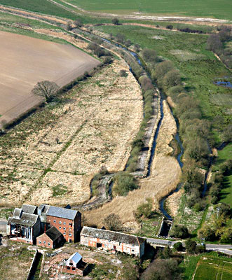
Ebridge Lock No 3 |
Ebridge Mill |
5 |
3 |
U |
TG31112976 |
|
Spa Common Bridge |
North Walsham 1 mile |
5.9 |
3 |
U |
TG29943059 |
|
Bacton Wood Lock No 4 |
6 |
4 |
U |
TG29893072 |
||
Austin Bridge |
6.5 |
4 |
U |
TG29773141 |
||
Swafield Bridge |
Swafield Mills |
7.3 |
4 |
U |
TG28633195 |
|
|
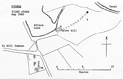 |
Tithe map 1840 - as redrawn by Harry Apling |
 |
|
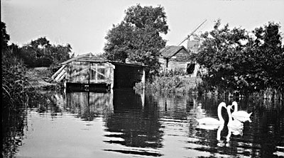
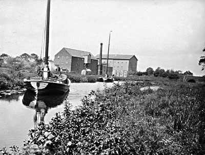
Dilham staithe 1929 |
 |
 |
|
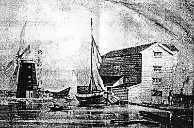
Dilham mill & lake 1837 - watercolour painting by Edmund Girling
|
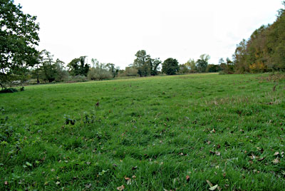
Dilham lake 19th October 2003 |
|
The wherry in the above painting belonged to William Harrison Wells of Dilham_mill but the presence of the windmill was artistic licence. |
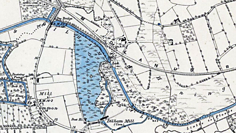 |
O. S. Map 1885 |
 |
 |
|
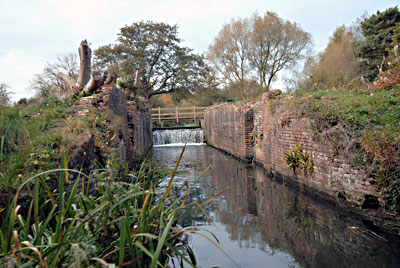
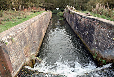
Honing lock 19th October 2003
|
|
 |
 |
|
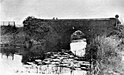
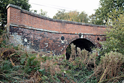
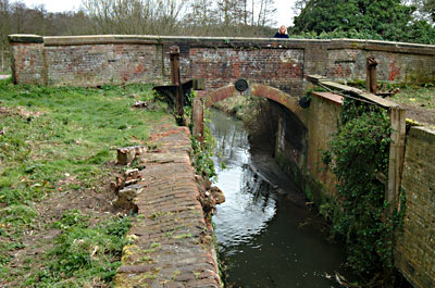
Honing bridge c.1912 |
Honing bridge 19th October 2003 |
 |
 |
|
Briggate Mill and bridge 1928
|
Briggate Lock 1928 |
 |
 |
|
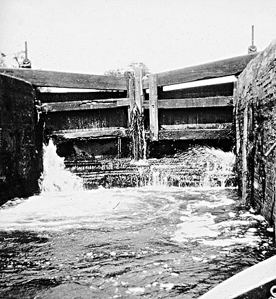
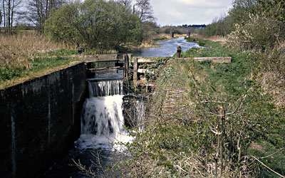
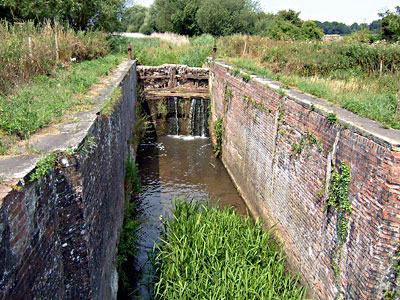
Briggate lock downstream 6th April 2003
|
|
 |
 |
|
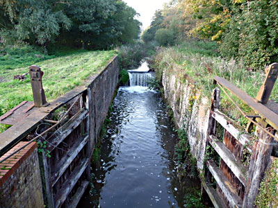
Briggate lock April 1967 |
Briggate Lock 12th October 2008 |
|
Coal traffic did not materilise as expected - however corn, flour, timber, cattle cake and animal feedstuffs were important cargoes - and included the cabbage Wherry from Antingham to Yarmouth market. |
|
In 1836, after only 10 years the canal began to silt up, partly because
the head of water along the canal was very small and was only sufficient to operate the locks to allow three wherries to sail each way each day. |
 |
 |
|
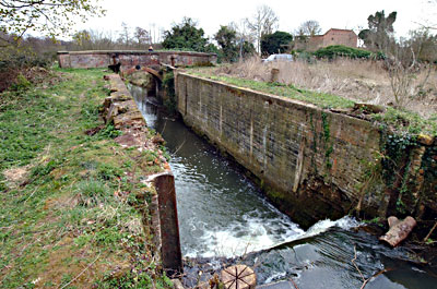
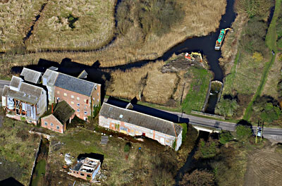
Ebridge site 5th April 2007 |
Ebrifdge mill & lock 7th March 2011 |
 |
|
Ebridge lock 27th July 2006
|
 |
|
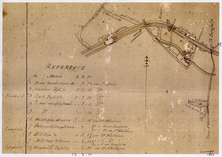
Swafield survey map 1832 |
 |
 |
|
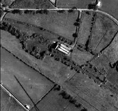
Antingham Lower Bone Mill & basin 1946
|
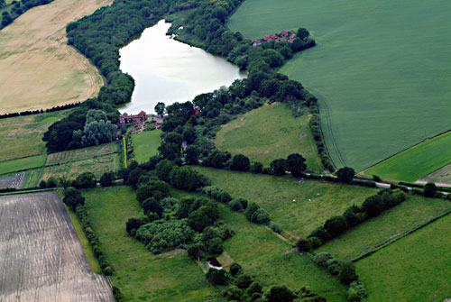
Antingham basin site in the forefround with Antingham Upper Bone Mill at the head of the lake 30th June 2004 |
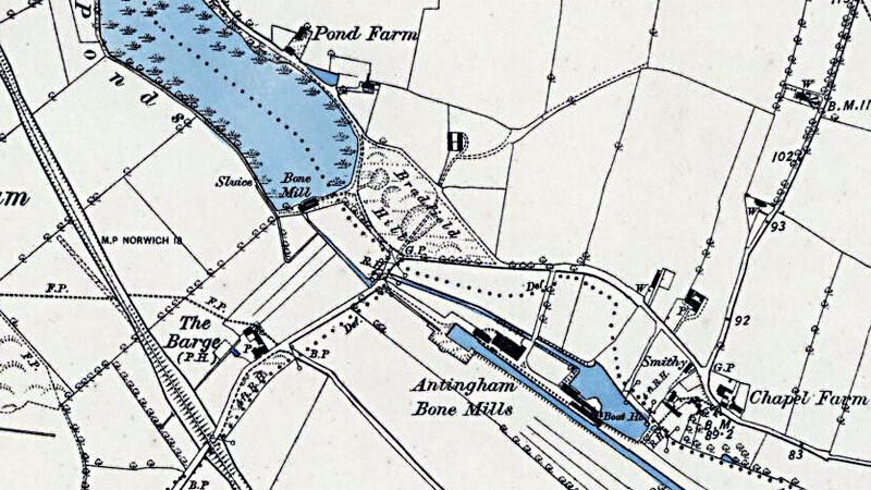 |
O. S. Map 1885 |
Enthusiasts are hoping to re-introduce water to a dry section of Norfolk's only canal. |
They have sent a plan to the Environment Agency for re-watering a section of the North Walsham and Dilham Canal above Bacton Wood lock, which is itself above Bacton Wood Mill. |
Canal restoration ends in a spot of hot water |
Restoration work on the North Walsham and Dilham Canal has proved controversial. |
January & September 1811: John Millington carried out two surveys re building of a canal |
If
you have any memories, anecdotes or photos please let us know and we may
be able to use them to update the site. By all means telephone 07836 675369
or
|
Copyright © Jonathan Neville 2012 |