Mill site 24th July 2011
| Shereford Mill
(South Mill) River Wensum |
|
|
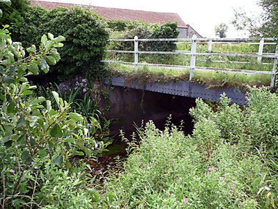
Mill site 24th July 2011 |
|
South Mill in the parish of Shereford had ceased working and had been demolished many years before 1836, when it was mentioned in White's Directory. |
 |
 |
|
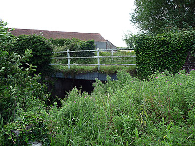
Mill site with South Mill in background 24th July 2011 |
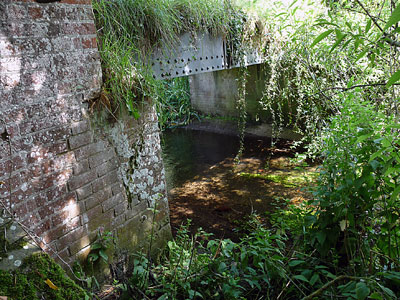
Wheelrace 24th July 2011
|
 |
 |
|
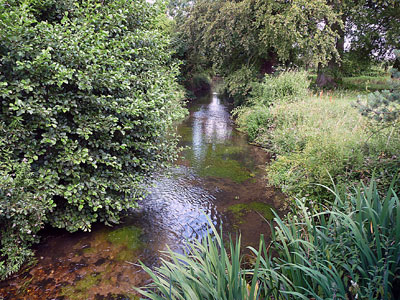
Mill tailrace 24th July 2011 |
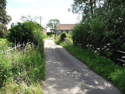
Road from mill to South Mill Farm 24th July 2011
|
 |
 |
|
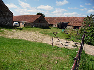
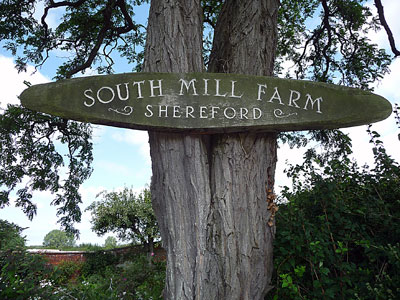
South Miill Farm 24th July 2011 |
|
Mills |
|
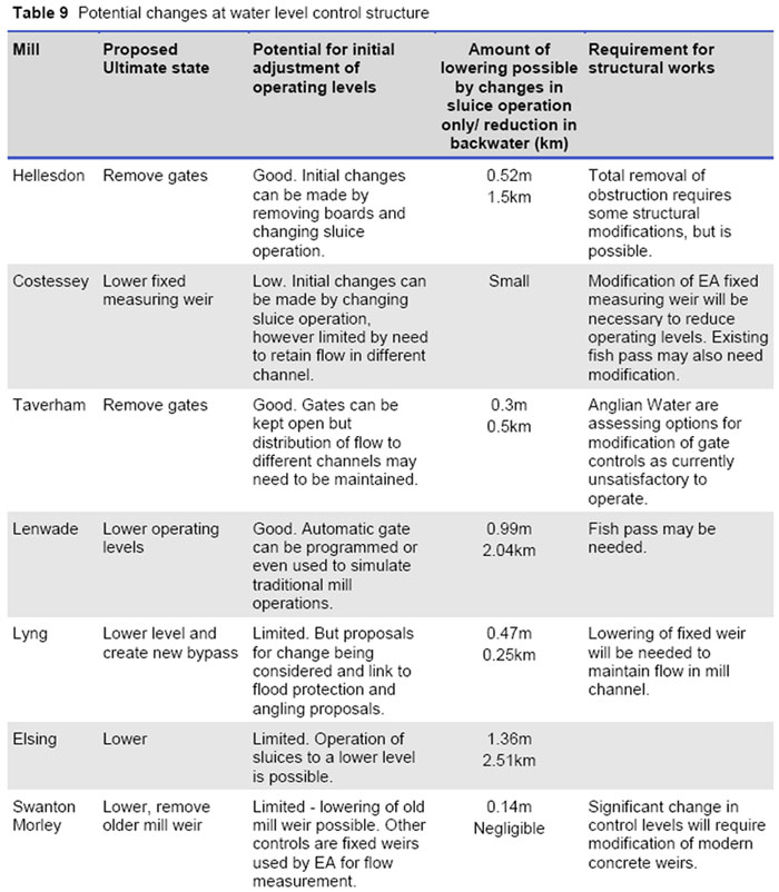
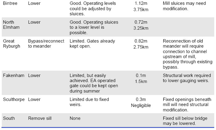
6.16 The mill structures have a profound influence on the river system in the Wensum catchment. If high retained water levels continue upstream of the mills, they would form a significant constraint on the effectiveness of river restoration. Physical modifications at mill sites should aim to restore a more natural longitudinal profile to the river and to remove or reduce physical barriers to the movement of fish and wildlife. Whilst historically a number of mills have been in existence for centuries these have always very actively stored and released water and the cessation of working of the mills in combination with dredging has had a significant impact. 6.17 The recommended actions at mill structures are shown in Table 9. At a number of sites there is no mill building and removal of water level control structures would be the desired course of action. However, often there are multiple channels at a mill site and it is likely that some hydraulic controls would be needed to maintain a split of flows to all channels. These would probably take the form of a fixed crest and a natural chute that would allow the passage of fish and woody debris. At locations where the water level control structures are part of the historic mill building, there is often a variety of passageways and the best way to lower levels will need to be identified using more detailed survey. Initial action can be taken at low cost by merely adjusting operating levels using the available gates and stop boards. The reduction in head that could be achieved at a typical dry weather flow is also summarised in Table 9. The estimated maximum reduction in backwater length through changing the operational level of the sluices (that is, without the need for major engineering works) is 18km. This would reduce the length of the River Wensum SSSI affected by backwater from mills from 67% to 40%. To achieve this it would be necessary to ensure that no channels downstream of gates or fixed weirs are affected, but this could be a cost effective start to the Wensum restoration. 6.18 It is likely that at some locations, where the channel course has been altered and the mill channel is significantly higher than the natural channel, the main flow could be diverted upstream of the current mill location. Maintaining some flow to the original mill weir is likely to be preferable for aesthetic and heritage reasons, so by-passing is likely to be required in conjunction with lowering of the mill weir. Sites where such a solution is envisaged are at Great Ryburgh and Lyng. 6.19 The control structures at Costessey, Swanton Morley and Fakenham are used for flow gauging by the Environment Agency. Lowering these weirs may mean that the existing gauging arrangements will need to be replaced by other methods, such as ultrasonic techniques. The weir on the main channel at Swanton Morley has a two stage drop and a significant reduction in water level could be achieved there without affecting flow gauging through the bridge. 6.20 A former mill known as Gogg's Mill near to Fakenham was removed as part of the drainage improvement works of the 1950s. The channel upstream of the mill has narrowed significantly through the accretion of silt berms, and provides a good case study of the extent to which natural recovery can help restore natural river form and function. 6.21 As part of the River Wensum Water Level Management Plan being prepared by Entec (2007) the views of some private owners on changes in operating level have been canvassed. In broad terms this is not opposed, but there is concern to maintain an attractive setting incorporating some mill pond in line with the historical context particularly at: 1) Elsing 2) Great Ryburgh 3) Bintree 4) North Elmham 5) Lenwade. 6.22 A reduction in the retained water level at mills may constrain the ability to direct water through all the existing channels at mill sites, should this still be required, there may be a need to carry out physical modifications to some of the subsidiary water level control structures. River Wensum Restoration Strategy - Natural England, 26th June 2009 |
Summary of
Requirements: All works must integrate with removal of sill-type structure at South Mill and any associated river works. Reinstate meandering channel with appropriate sinuosity and fill in the existing channel that was created as a diversion when South Mill was in use. The original channel is not evident on the floodplain, although a drain seen on the OS map along the left bank of the Wensum may represent a previous river course. Further, as there are no suitable reference reaches at this location in the catchment, restoration channel dimensions should be based on hydraulic geometry calculations. It would be suitable to reconnect the restoration channel with the existing channel at the road bridge by South Mill. Develop marginal/bankside vegetation, with some riparian trees. Connect to drains or create off-river refuges. River Wensum Restoration Strategy - Natural England, 26th June 2009 |
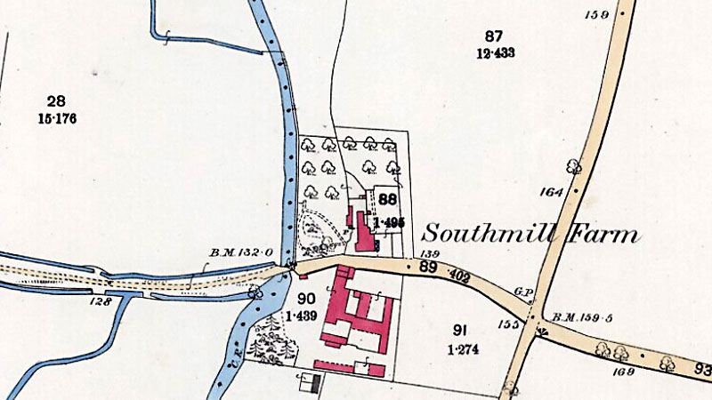 |
O. S. Map 1885 |
| White's 1836: | The farm called Southmill, had anciently a corn mill, and was given by Sir Robert Knollys to the college which he founded at Pontefract |
Kelly's 1879: Thomas Raby Norton, farmer, South Mill Farm |
|
If you have any memories, anecdotes or photos please let us know and we may be able to use them to update the site. By all means telephone 07836 675369 or
|
| Nat Grid Ref TF88252831 | Copyright © Jonathan Neville 2009 |