 |
|
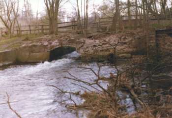
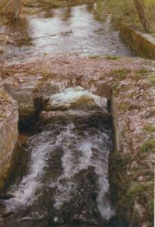
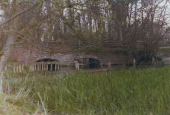
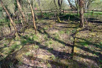
Northern tailrace 1977
|
|
Buckenham Tofts
Mill
River Wissey |
|
|
Northern tailrace 1977
|
Buckenham
Tofts watermill was another estate mill that has long disappeared. Although
it was still in use in 1928, by 1977, all that was left was some brickwork,
the old wheelrace channels, part of the weed grid and some ironwork on the ground
with one gear wheel. One section of the ironwork bore the date 1840, which
almost certainly relates to the time of the mill's reconstruction. |
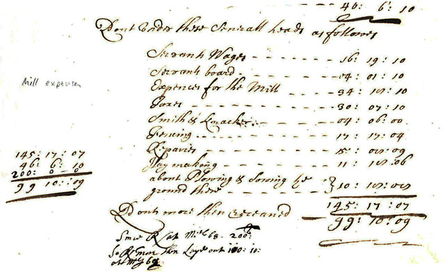 |
Mill repairs from manorial records May to Michaelmas (29th Sept) 1667 |
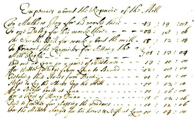 |
Mill repairs from manorial records May to Michaelmas (29th Sept) 1667 |
The document is part of a very rare C17th set of estate and other accounts in an even rarer binding. It states that the expenses were for the period from May 1667 and for repairs to the mill. It seems as if the stones were carried by water to Brandon and then carted to Buckenham Tofts. |
 |
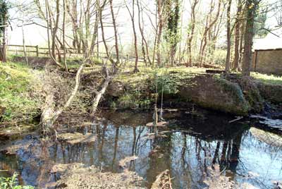 |
Northern tailrace 1977 |
Northern tailrace 21st April 2005 |
 |
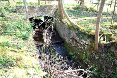 |
Northern wheelrace in 1977 |
Northern wheelrace 21st April 2005 |
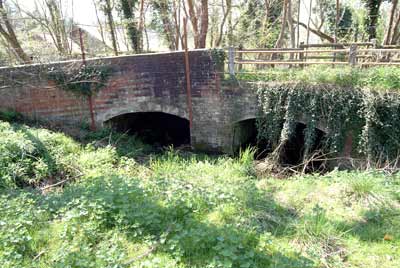
| By 2005 the northern wheel channel tailrace arch had collapsed and the majority of its water had been diverted to the mill bypass by virtue of filling in the mill dam leaving just a small channel that presumably helped in times of flood. |
 |
 |
Mill dam and weed grid November 1968 |
Mill dam filled in 21st April 2005 |
 |
 |
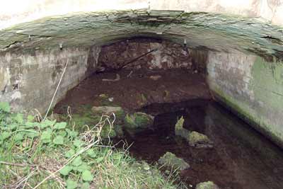
Wheel channel inlets 1977 |
Wheel channel inlets 21st April 2005 |
 |
Southern wheelrace channel filled in 21st April, 2005 |
At around the time the mill was demolished the southern wheel channel was filled in for the majority of its length. The ironwork and remaining gearwheel indicates that the channel may well have housed a turbine. The keystone above the southern wheelrace arch bears the inscription LP 1761, which probably relates to when the mill was built or rebuilt. |
 |
 |
Southern wheelrace channel 21st April 2005 |
|
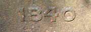 |
Closeup of the 1840 date |
 |
 |
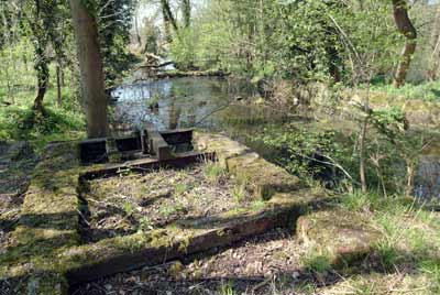
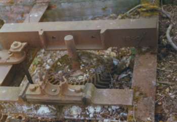
Gearwheel and dated ironwork (top right) in 1977 |
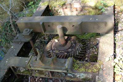
Gearwheel and ironwork 21st April 2005 |
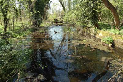 |
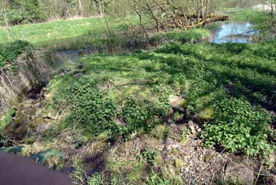
Millpool 21st April, 2005 |
 |
Estate map c.1770 |
Pig’s Ear puts Farmer through the Mill |
Farmer Mr. Dennis Burton was surprised to read that the historic Old Buckenham Mill on his farm was to be turned into a youth field centre. For Mr. Burton, of Mill Farm, Old Buckenham, knew nothing about any scheme and he did not want a field centre on his farm. When his neighbours also read about the £20,400 scheme they were none to pleased, either. “People are getting a bit hot under the collar thinking it’s something to do with me,” Mr. Burton said yesterday. “The first I saw of it was in the paper, and then when I went down to the local and they told me I was in the Sunday Express.” The information, which started the furore at Old Buckenham came from a Manpower Services Commission Press release. The Commission said it was going to give Old_Buckenham_Mill, an early 19th century windmill a new lease of life. Two craftsmen and eight unemployed youngsters would put in lavatories, showers and partitions so the mill could be used as a centre for field studies, painting and other activities. The mystery was finally cleared up by Norfolk County Council Youth and Community officer, Mr Cyril Grant, who is sponsoring the scheme with the commission. “The mill we are converting is at Buckenham Tofts, near Mundford, on the edge of the battle area,” he said. The brick and flint watermill stands beside the River Wissey, next to a campsite already used the county council youth service. With the £20,400 grant from the commission, plus £5,000 from the West Norfolk Jubilee Trust and some money from the county education budget, the empty building will become a much needed field centre for the area. Mr. Grant was certain Norfolk County Council had no designs on Mr. Burtons mill and neither had the commission. Finally the gaffe was traced to the Central Office of Information in Cambridge, where the existence of four Norfolk Buckenhams had not been suspected. “In the research for the Press release some of the wires got crossed; that’s clearly what happened.” said the regional information officer, Mr Ian McKellar. ”I hope it hasn’t worried him too much. I am sorry if he has been upset by it. It does seem to be a pigs ear we have made.” he admitted. “Let’s face it, with four Buckenhams, we had a 25% chance of being right. We hope it won’t be a millstone round our necks.” Eastern Daily Press - 24th January 1979 |
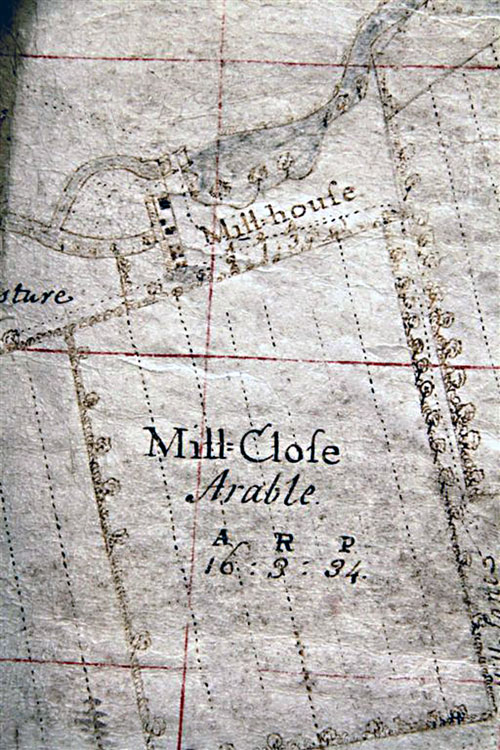
One of the millstones was squared off and set in the bank as a step. |
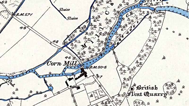 |
O. S. Map 1882 |
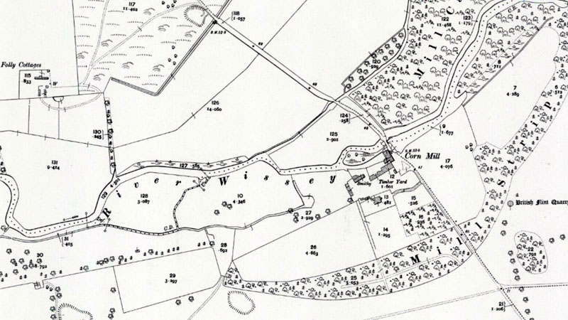 |
O. S. Map 1904 |
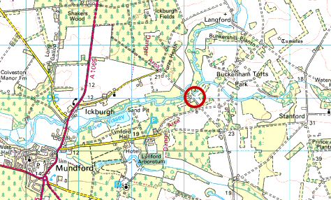 |
O.S. map 2005 Image reproduced under licence from Ordnance Survey |
| Manorial record 1667: Expenses for mill repairs listed included many building materials 1761: Probable date of mill restoration as recorded on the southern wheelrace arch keystone: LP 1761 Faden's map 1797: Mill 1840: Probable date of rebuild O.S. map 1882: Corn Mill O.S. map 1904: Corn Mill 1928: Still in production RAF aerial photo 1946: Mill buildings visible 1968: Only foundations left |
If you have any memories, anecdotes or photos please let us know and we may be able to use them to update the site. By all means telephone 07836 675369 or
|
| Nat Grid Ref TL8309 9503 | Copyright © Jonathan Neville 2005 |