 |
|
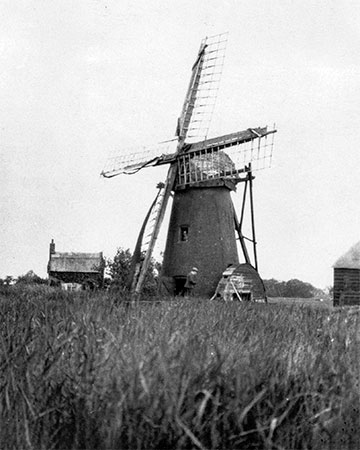
c.1926 |
|
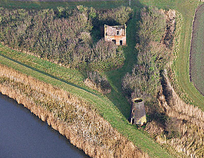
Stokesby Old Hall dainage mill was quite small with a tarred red brick tower and the scoopwheel was powered by the older design common sails turned to wind via a tailpole. It was built near the river with a cottage close by. The mill was also known as Dack's Mill. |
 |
 |
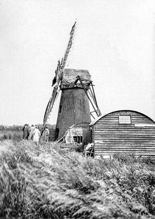
c.1926 |
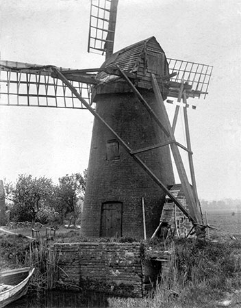
c.1930 |
 |
 |
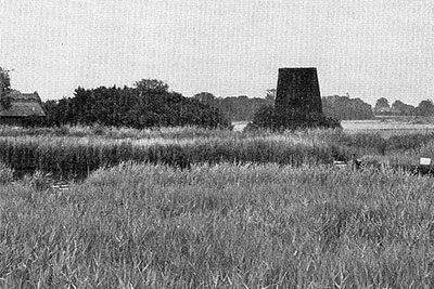
10th July 1973 |
1st December 2009 |
The ruined drainage mill is situated to the south of a marshman's cottage. These two buildings stand in an isolated location beside the River Bure. The mill is located beside and behind a modern flood bank. It is visible from the A47 (Acle Straight) to the south. The brick walls are in relatively good condition. There are two doorways (one on the east and one on the west), one window opening (on the west) and an arched opening on the south. The doorways and window opening have timber lintels. The arch of the arched opening is brick. On the outside the walls have a coating of coal tar. Inside limewash remains on the walls on the ground floor (the upper walls may not have been limewashed). All the machinery has been removed. It is not clear if remains of the kerb and/or track survive on the wall tops. The beams for the floor at first floor level survive. Internal holes with timber lintels at second floor level would have been associated with machinery. The original floor level is currently concealed by soil. A brick and timber structure stands in the centre of the floor. This could have been the frame for the drive shaft or a bed for an engine that replaced wind power. Outside to the east there is a brick lined pit and culvert, with sluice gates at either end. This structure would have held an external scoop wheel, which would have pumped water from north to south. Neither the cap nor the sails survive. It is likely the sails were cloth and timber framed. This ruined tower drainage mill dates to the 19th century. It would have pumped water into the River Bure from land to the north. D. Robertson - 12th April 2013 |
 |
|
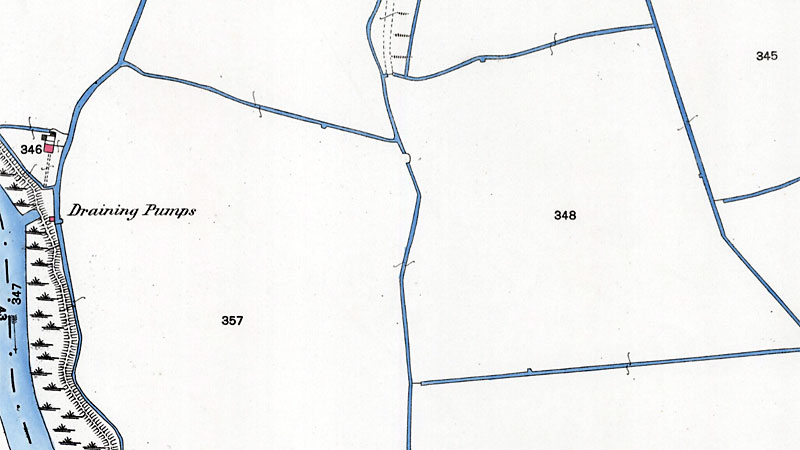
O. S. Map 1884 Courtesy of NLS map images |
O.S. map 1884: Draining Pumps 1973: Tower only remaining 1985: Derelict tarrred red brick tower and derelict thatched cottage nearby 2009: Derelict tower and cottage |