 |
O.S. Map 1884 Courtesy of NLS map images |
|
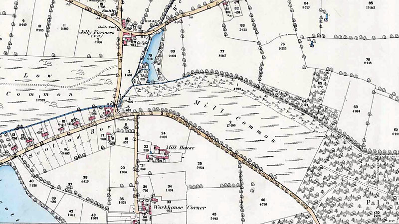
Swanton Abbot
postmill |
Swanton Abbott postmill stood to the south of the village on Hill Common. The mill was built with common sails to power two pairs of French burr stones and a flour mill. By 1863 the mill had been fitted with patent sails. |
Notice re Insolvency of |
|
James Elvin's cousin, William, was running Marsham postmilll in the 1830s. |
To Millers and others |
TO MILLERS |
To Millers and bakers. |
To be Sold by Private Contract.
An excellent Post Windmill, in full trade, situate in Swanton Abbott, in the county of Norfolk, driving two pair of stones, with flour mill and going gears complete. Also a dwelling house, cottage, Baking Office, Granary and other outbuildings, Yards and large garden attached, now in the occupation of Mr. Rayner. |
To Millers |
SALE by AUCTION without reserve. With immediate possession. |
SWANTON ABBOTT near North Walsham. |
SWANTON ABBOTT |
SWANTON ABBOTT |
SWANTON ABBOTT |
SWANTON ABBOTT |
SWANTON ABBOTT |
SWANTON ABBOTT |
TO MILLWRIGHTS, MILLERS and OTHERS |
A cousin has a decanter with a windmill etched on to it, attached, with W & HE. We assumed it was a tower mill, but William & David Elvin were at Marsham_post_mill. A cousin of theirs (we also assume as stated in censuses) was James Elvin at Swanton Abbott post mill. But the earliest of our ancestors were Jonathan & Ann Elvin of Swanton Abbott, whose tower_mill is 'about 1845' - too late for any Elvins. The decanter also has W&HE for William (1790-1858) & Hannah (1792/3-1838) Elvin. who married in 1817. These dates suggest the decanter is between 1817 and 1838, when William was definitely at Marsham! |
|
O.S. Map 1884 Courtesy of NLS map images |
|
October 1831: James Elvin, miller insolvent |
If you have any memories, anecdotes or photos please let us know and we may be able to use them to update the site. By all means telephone 07836 675369 or
|
| Nat Grid Ref TG26682680 |
Copyright © Jonathan Neville 2008 |