Site of mill under red dot
Estate map 1765
Estate map 1765
|
Scoulton
postmill |
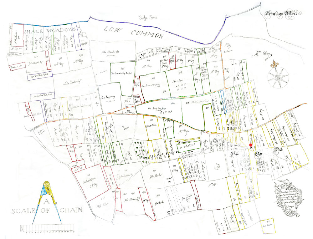
Scoulton post windmill was working in the late 1200s. A map has now come to light showing the mill position on Mill Hill Field in 1765. However, to identify the site on a more modern map is not overly easy, as the road and track layouts have altered dramatically and the surveyors in the 1700s did not have modern equipment to ensure accuracy. |
|
This manor had free-warren, assize of bread and beer, a manor-house, windmill and fishery and was worth £11. 7s. per annum in 1282. |
|
Site of mill under red dot Estate map 1765 |
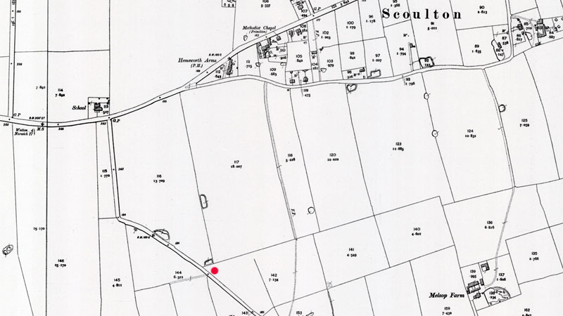 |
Possible site of mill O. S. Map 1905 Courtesy of NLS map images |
If you have any memories, anecdotes or photos please let us know and we may be able to use them to update the site. By all means telephone 07836 675369 or
|
| Nat Grid Ref TF984300032 |
Copyright © Jonathan Neville 2023 |