Summary:
An undated, ' hengiform ' ring ditch , perhaps the site of a medieval to post medieval windmill , is visible as a cropmark on aerial photographs. The ring ditch is distinctive in having a wide ditch, with two opposed entrances or causeways, and a probable internal, centrally located pit. Some of these characteristics are shared with Late Neolithic and Early Bronze Age hengiform monuments , and with other funerary and/or ceremonial sites dating to the prehistoric period. They are also a common feature of medieval and post medieval windmill sites, however, and this later date and more mundane interpretation is preferred here. The site lies at the northern end of an extensive linear settlement (see NHER 50727) of possible late medieval to early post medieval date, with which it could be associated, as may the enclosure (NHER 29575) visible in this same field.
Full Description:
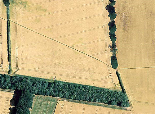
January 2008. Norfolk NMP .
An undated ' hengiform ' ring ditch is visible as a cropmark on aerial photographs (S1)-(S5), centred at TG 2936 1490. It is distinctive in having a wide ditch, with two opposed entrances or causeways, and a probable internal, centrally located pit. Some of these characteristics are shared with Late Neolithic and Early Bronze Age hengiform monuments , and with other funerary and/or ceremonial sites dating to the prehistoric period. They are also a common feature of medieval and post medieval windmill sites, however, as shown by work undertaken by the Essex Cropmark Enclosures Project (see Brown and Germany 2002 (S6); also compare NHER 50759 at Crostwick). This later date and more mundane interpretation is preferred for the site described here, which also lies at the northern end of an extensive linear settlement (see NHER 50727) of possible late medieval to early post medieval date, with which it could be associated. The enclosure (NHER 29575) visible 45m to the northwest on the same aerial photographs is also likely to be contemporary with this settlement.
The ring ditch is roughly circular in plan and measures up to 28.5m in diameter externally and at least 18m in diameter internally. Two opposed entrances are visible, facing northwest and southeast. Other details of the plan are less clear, as the cropmarks show differently on different aerial photographs (it has been mapped as visible on NLA obliques taken in 1986 (S3)). It does appear, however, to possess an internal, centrally located pit, perhaps relating to a post mill , although this could instead be of geological or recent agricultural origin.
S. Tremlett (NMP), 23rd January 2008 -
Norfolk Heritage Explorer website - 2009 |