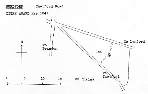
Tithe map 1842 - as redrawn by Harry Apling
|
Mundford
smockmill |
|
Mundford smock windmill stood to the southeast side of the village on the east of the Thetford road and ran a single pair of 4ft. French burr stones. |
|
Tithe map 1842 - as redrawn by Harry Apling |
Tithe Award 1844 |
||||
No. 149 |
Mill Close |
Arable |
13a. 0r. 30p. |
14. 2 |
To Millers, Millwrights and others |
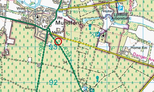 |
O.S. Map 2005 Image reproduced under licence from Ordnance Survey |
| O.S. map 1824: Windmill Pigot's 1830: Richard Burton, miller & flour dealer, Mundford Greenwood's map 1834: Windmill White's 1836: Richard Button, miller & baker Tithe Award 1844: Owner: Sir Richard Sutton, Bart; Occupier: James Debenham March 1859: Mill advertised for sale by auction to be removed |
If you have any memories, anecdotes or photos please let us know and we may be able to use them to update the site. By all means telephone 07836 675369 or
|
| Nat Grid Ref TL80659314 |
Copyright © Jonathan Neville 2008 |